A brief history of Walthamstow
|
[1] Ancient House [2] River Lea [3] The Copper Mill |
 |
|
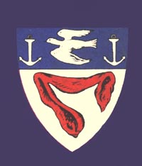
The
Walthamstow Crest |
 |
|
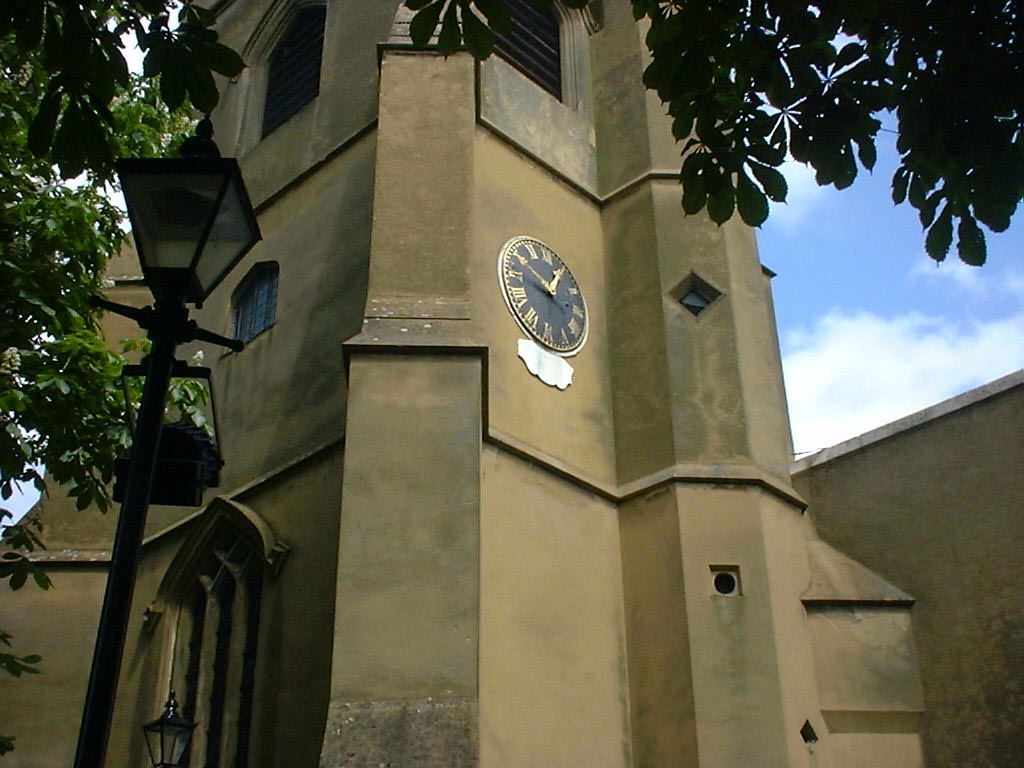
St. Mary's Tower taken in 2004
|
|---|
 |
|
Post Card of Saint Mary's dated
December 1903
|
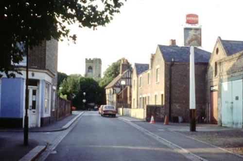 |
| Looking towards St. Mary's Church down Orford Road. The "Nags Head" is on the right, The rear of the "Ancient House" can be seen at the end of the road on the right. Taken in September 1981. |
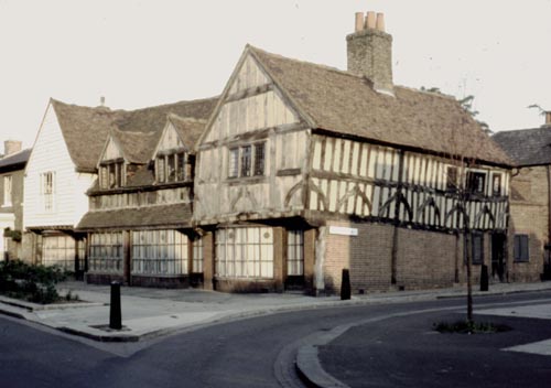 |
| The 15th
century "Ancient House" Walthamstow Village in September 1981. |
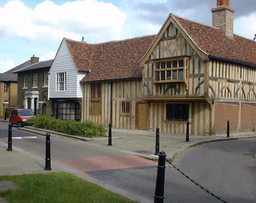 |
| The "Ancient
House" Walthamstow Village taken in April 2002 during the restoration work. Notice that the dorma windows have gone, as these were not part of the original 15th century structure. |
|
The word Walthamstow is derived from "Weald" meaning - wood, "Ham" meaning - a manor (Ham is also where the English word "home" originates) and "Stow" meaning - a place. The stow had to be included to distinguish Walthamstow from nearby Waltham Abbey and Waltham Cross. Walthamstow is situated in the North-eastern corner of London, six and a half miles from the city centre and bordering on the edge of Epping Forest in the county of Essex. Other neighbours are the boroughs of Woodford to the east, Chingford to the north, Leyton to the South and the River Lea or Lee* to the west. Over the centuries, Walthamstow has had many variations on it's name. The most commonly known is the entry in the Domesday Book of 1086 as "Wilcumestou". A farming community with a population of 82 and a value of £28 and 2 ounces of gold! That's inflation for you as twenty years earlier it was valued at just £15.
|
|
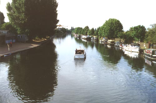
In the ninth century, it is thought that the River Lea must have been at least a mile wide with marshland on either bank and dense woodland as far as the eye could see. This was probably the scene that Viking invaders met as they sailed up the river to invade Hertford. The sorce of the River Lea is in Bedfordshire, approximately 3 miles north-west of Luton at a place called Leagrave Marsh. It is 70 miles long, and drops 300 feet by the time it joins the River Thames at Blackwall. For more information on the River Lea, CLICK HERE |
 |
|
River Lea from Springfield Marina
Bridge 2004.
|
 |
|---|
|
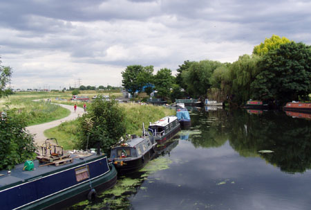
River Lea looking south towards
Lea Bridge Road 2009
|
 |
|
What time is the next River
Bus?
|
| [*The spelling of the River Lea has changed over the last few centuries. In 1190 it was refered to as "The Water of Lin", in the 14th century as "La Leye". It would seem that "LEA" was introduced around 1576. In the 18th century, it was sometimes refered to as "The Ware River". In a 1747 map of Walthamstow drawn by John Noble, the River clearly has the spelling "LEE", yet by 1822 it had changed back to "LEA" . Nowadays, the spelling "LEE" is generally used when referring to any commercial use of the river, such as the "Lee Valley Park" or "Lee Valley Campsite", but reference to the river itself still has the "LEA" spelling as in "Lea Bridge Road".] |
| According to the Domesday book, Walthamstow had "always had a mill" of some sort or another. Although the exact whereabouts is not known, it is fairly certain that there has been a mill on the site of the Copper mill, near the River Lea, for a very long time. In the 14th century, the mill was powered by a mill stream diverted from the River Lea known today as the Coppermill Stream. Corn was ground there at this time. Then in the 1670's gunpowder, in 1690 it was used for rolling paper and the stream was named "Papermill River". In 1712 it was a Leather Mill. It's next use was in the manufacture of linseed oil. In fact, on an old map of 1743 it was marked as "Oyl Mill". |
 |
|
The Coppermill from Coppermill
Lane.
|
|---|
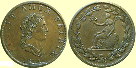
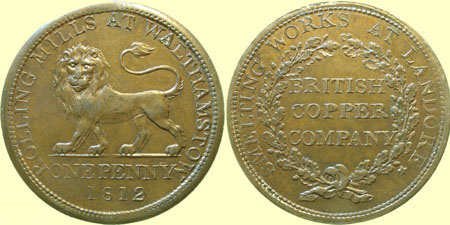
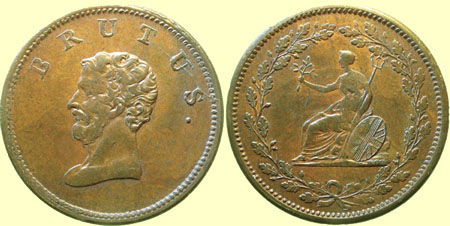
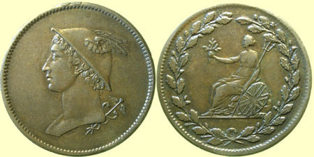
| In 1808, the whole site and some surrounding marshland was put up for sale. It was puchased by a Welsh based company known as the "British Copper Company". The copper was smelted in "Landore" near Swansea in South Wales and brought by barge around the south coast up the Thames and the Lea, then up the Coppermill Stream to the mill. The original wooden unloading crane can be seen in the above picture. The copper ingots were then rolled into thin sheets which were sent all over the Country to be stamped into coins. These were penny and half penny tokens. |
|
Here are some examples
of tokens using copper rolled at the copper mill. The coins were probably
pressed in Birmingham.
|
|
Description
|
HEADS
|
TAILS
|
|
1811 BCC |
 |
|
|
1812 BCC
One Penny token |
 |
|
|
BCC
Half-Penny Token Issued between 1811 and 1813 |
 |
|
|
BCC
Half-Penny Token Issued between 1811 and 1813 |
 |
|
|
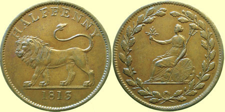
1813 BCC
Half-Penny Token |
 |
|
|
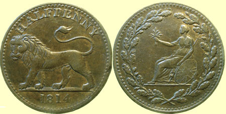
Contemporary fake of an
1814 Walthamstow Half-Penny Token |
 |
|
|
Images courtesy of Paul Withers. © "These tokens were not exclusively
for use in Walthamstow. The main purpose of the BCC They are likely to have been used
mainly in London and Swansea - Walthamstow and Landore will have been
relatively minor outlets for them. The halfpennies do not bear the
name of a place where Extract from "British Copper Tokens 1811-1820
by P & B R Withers" |
|
It is worth mentioning at this point
that Marsh Street ran from Hoe Street right down to the River Lea.
The section from Blackhorse Lane to the river was renamed Coppermill
Lane to commemorate the Copper Rolling Mills. The mill became an important employer
of local people; within two years of the copper company arriving, Walthamstow's
population increased by a third. Soon afterwards, the mill was purchased by The East London Water Company who started building reservoirs on the marshes. One of the water wheels of the mill was altered to drive a water pump for building their reservoirs. There was no tower at the mill until 1864 when it is thought to have been added maybe to house a steam engine. The mill house was demolished in 1941. |
 |
|
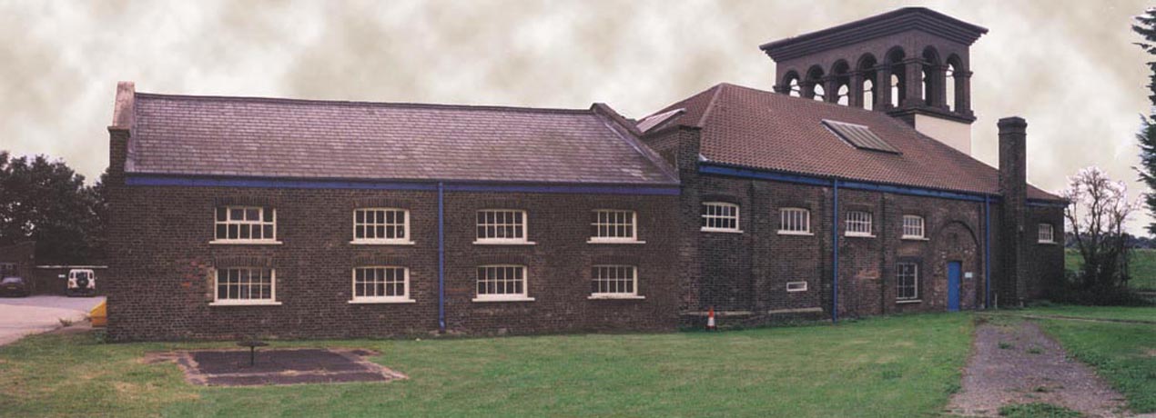
The Coppermill from the back.
It is not often seen from this angle, but as Thames Water had an open
day it was too good an opportunity to miss!
|
|---|
Thames Water still uses the building as a store.
The Lighthouse Methodist Church
 |
|
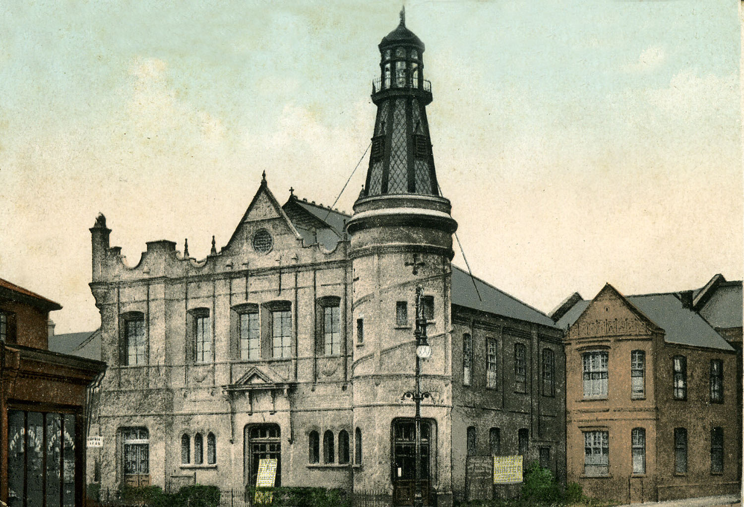
The Lighthouse Methodist Church.
Markhouse Road c1910.
(Commercial Post card) |
|---|
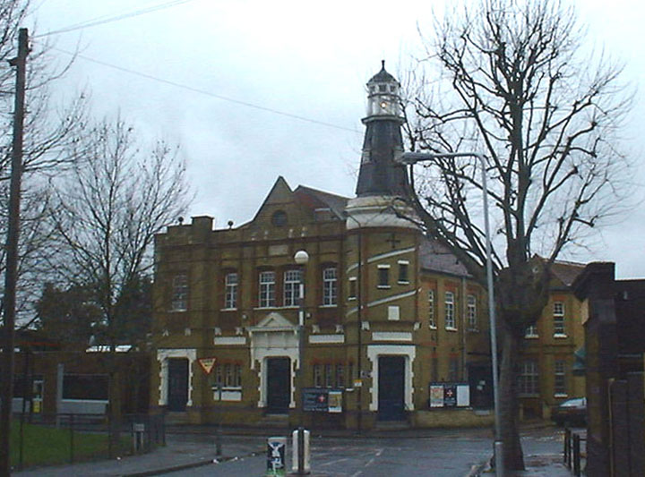 |
| The Lighthouse Methodist Church. Markhouse Road in 2004. |
|
In 1887 a group of young people from the Wesleyan Church
in Blackhorse Lane became interested in doing more evangelical work
than their church were involved with at the time. So they found a house
in Myrtle Road Walthamstow and made some alterations to accommodate
the growing numbers of their congregation. Actually, more and more of
the members were coming in from the Blackhorse Lane church.The Superintendent
was not happy at all, and gave the leaders of the group the ultimatum
"Come back or lose your Church Membership." Well the answer
was a resounding NO! Gradually, the house in Myrtle Road became too small and this is where Captain King of the "Bullard King Steamers" appears on the scene. For it was he that purchased a plot of land (on the southerly corner of Markhouse Road and Downsfield Road) and erected a large tent. This was used for services up to 1889 when Captain King donated an Iron Hall at a cost of £250. This seated 250 people. Soon a strong church was established under the leadership of Walter Mines. In 1893, the present building was erected which seated 853, and the Iron hall was transported to Lloyd Park when the church there was founded. Why a lighthouse 35 miles from the sea? This was at the
request of Captain King who ironically died the same year. A big effort was successfully made to clear all debts on the church during 1914-18 war "before the boys came home" and during the 1920s, £1,000 was raised for re-seating and re-heating the church. The Lighthouse sustained some damage by incendiary bombs during the Second World War, but managed to weather the storm! In 1967 (the Lighthouse's 80th birthday) there was a flourishing Sunday school which saw three of its members become Methodist Ministers. There has been some doubt as to the future of the Lighthouse church, but a few weeks ago the whole of the outside was renovated, and it now looks superb. |
 |
|
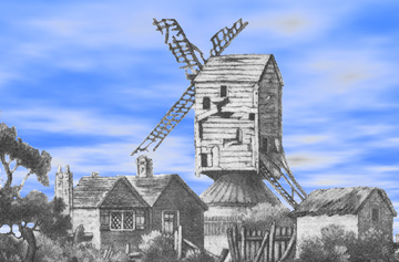
The Walthamstow Windmill (1676
to 1800)
|
|
Yes! There was a Windmill in Walthamstow between 1676
to 1800. The main Woodford road ran further West than it does today,
roughly following the path of the horseride. (Blue line on map). There is little evidence concerning the mill, except in
the parish registers where several millers are named, the last being
Mr. Fitch from 1791 to 1800 when it must be assumed that the mill was
demolished.( I have since read that the mill was blown down.)
|
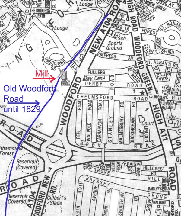 |
|
Map of what is now parts of Woodford showing
|
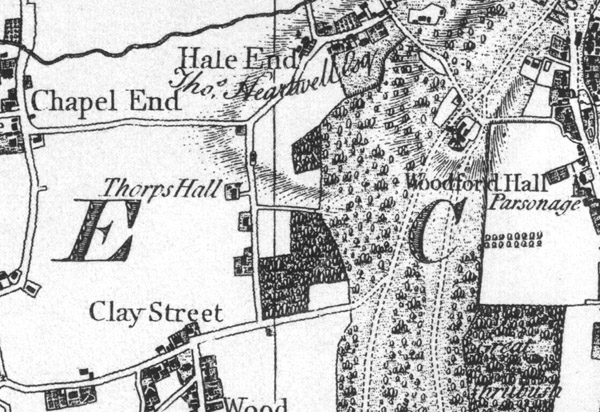 |
|
Section of Chapman & Andre's
map of Essex in 1777 showing Clay Street (Forest Road) and the Mill.
(Just above the word Woodford) |
|
Year
|
Population
|
|
1086
|
82
|
|
1801
|
3006
|
|
1811
|
3777
|
|
1821
|
4303
|
|
1831
|
4258
|
|
1841
|
4873
|
|
1851
|
4959
|
|
1861
|
7144
|
|
1871
|
11,092
|
|
1881
|
22,531
|
|
1891
|
47,154
|
|
1901
|
96,720
|
|
1911
|
124,580
|
|
1931
|
132,972
|
|
1951
|
121,135
|
|
1971
|
101,914
|
|
Still under
|
|
|
|
Information for this page was gleaned from various sources, but mainly from : - 1. The History of Walthamstow.
Published by London Borough of Waltham Forest. All photographs on this page copyright ©Richard Dunn. unless stated otherwise. |